India is a culturally rich country with 28 states and 8 Union territories. Before the British rule the country was not divided into states, however, as the British established their power in India they divide the nation into states. This division as states is still followed even after the independence.
List of Smallest States in India By Area
Here is a list of the smallest states of India. PS the list includes states only and not the Union territories.
10. Punjab
- Total area – 50,362 km2
- Population density – 550/km2
- Capital – Chandigarh
According to the Census of 2011 Punjab is the 10th smallest state in terms of its area. This state is known as the land of five rivers and shares border with states like Himachal Pradesh, Haryana, Jammu and Kashmir, and Rajasthan. The Punjabi language is their official language and the majority of its population is comprised of Sikh’s (58%).
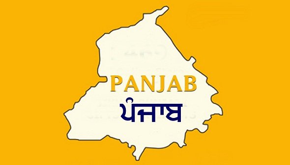
This state is also known as the food basket of India and the capital of the state is Chandigarh. The state animal of Punjab is Black Buck. One of the most notable specialties of this state is that majority of the land available in the state is used for cultivation and so, agriculture is the largest industry of this state.
Read Also: Top 20 Largest States in India
9. Haryana
- Total area – 44,212 km2
- Population density – 573/km2
- Capital –Chandīgarh
According to the Census of 2011 Haryana is the 9th smallest state in terms of its area. The state is significantly known as the “Abode of God” which means the presence of Lord Vishnu. The state has one of the most fertile lands of India and therefore also known as the “green land of India”. This state shares its border with states like Rajasthan, Uttar Pradesh, Himachal Pradesh, and Punjab.
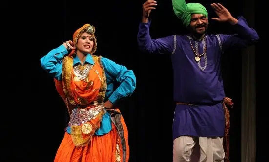
One of the notable specialties of this state is that this state along with Punjab has the same capital Chandigarh. Faridabad is the largest city in Haryana and Punjabi and Hindi is the official language of this state. Like the state of Punjab, Haryana also has Black Buck as their state animal.
8. Kerala
- Total area – 38,863 km2
- Population density – 860/km2
- Capital – Thiruvananthapuram
According to the Census of 2100 Kerala is the 8th smallest state in terms of its area. The state is known as “God’s own country” for the diversity of religion, culture, festivals, and temples. The state has several festivals that symbolize peace and unity. Kerala shares its border with Karnataka and Tamil Nadu.
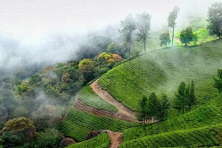
One of the notable specialties of the state is that it has the highest literacy rate in India (93.9%) and highest life expectancy (65.6%). The official animal of the state is Elephant and Malayalam is the official language. Kerala is one of the most popular tourist destinations in India.
7. Meghalaya
- Total area – 22,429 km2
- Population density – 140/km2
- Capital –Shillong
According to the Census of 2011 Meghalaya is the 7th smallest state in terms of its area. The state is known as the “Scotland of East” with incomparable natural beauty and features. This state is situated in the north-eastern part of India.
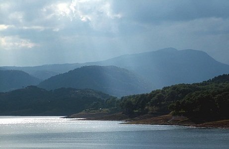
One of the notable specialties of this state is that it receives the highest annual rainfall (12,000 mm) and this, in turn, makes the state beautiful and filled with greenery. The beautiful landscapes in this state would leave any anyone astonished.
6. Manipur
- Total area – 22,327 km2
- Population density – 130/km2
- Capital –Imphal
According to the Census of 2011 Manipur is the 6th smallest state in terms of its area. This state is well-known as the “Jewelled land of North-East India” and is located 1500 miles away from Delhi. The state is known for its charm and beauty and shares its border with states like Mizoram, Assam, and Nagaland.
One of the notable specialties of this state is its natural splendour and the cultural treasure the state. The official language of the state is Manipuri (Meitei).
5. Mizoram
- Total area – 21,087 km2
- Population density – 52/km2
- Capital –Aizawi
According to the Census of 2011 Mizoram is the 5th smallest state in terms of its area. This state is remarkably known for its beauty and landscape. The state shares its border with Assam, Tripura, Manipur, and with neighbouring countries of Myanmar and Bangladesh.
One of the notable specialties of this state is its highest literacy rate (91.58%) however, the state has poor crop yields and the state practices shifting cultivation. Today, the state has a good bamboo as well as horticulture industry. The official language of the state is Mizo, English, and Hindi.
4. Nagaland
- Total area –16, 579 km2
- Population density – 119/km2
- Capital –Kohima
According to the Census of 2011 Nagaland is the 4th smallest state in terms of its area. This state is one of the only three Christian majorities state in India and well-known as the “Land of Festivals”. The state shares its borders with Mizoram, Manipur, and Meghalaya. Nagaland landscape is filled with mountains and 20% area is covered with wooden forest.
One of the notable specialties of this state is that the state is mainly inhabited by 16 major tribes and its sub-tribes. The state also is well-known for a year-long celebration and festivals. The official language of the state is English.
3. Tripura
- Total area – 10,491.69 km2
- Population density – 350/km2
- Capital –Agartala
According to the Census of 2011 Tripura is the 3rd smallest state in terms of its area. This state is well-known as the “Queen of North-East India” for the scenic beauty the state possess. The state shares its border with Mizoram and Assam and also with the neighbouring country Bangladesh. This state is known to have the most disadvantageous location in India as it has only one major highway that connects the state with the rest of the country.
This state receives heavy rainfall from the south-west monsoon and half of the land is covered with forest. The official language of this state is Bengali, English, and Kokborok.
2. Sikkim
- Total area – 7,096 km2
- Population density – 86/km2
- Capital –Gangtok
According to the Census of 2011 Sikkim is the 2nd smallest state in terms of its area. This state is known to have the world’s 3rd highest peak named Kanchenjunga. The state shares its borders with Tibet, Bhutan, Nepal, and West Bengal.

The state is well-known for its biodiversity and subtropical climatic conditions. One of the notable specialties of this state is that it has 11 official languages: Sikkimese, Nepali, Lepcha, Limbu, Sherpa, Newari, Manger, Gurung, Bhutia, Rai, and Tamang.
1. Goa
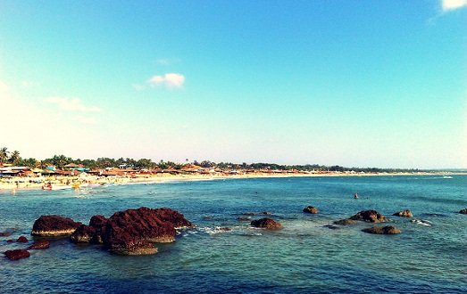
- Total area – 3,701 km2
- Population density – 490/km2
- Capital – Panaji
According to the Census of 2011 Goa is the smallest state in terms of its area. This state is well-known as the “Land of Christ and beautiful churches”. This state shares its border with Maharashtra and Karnataka.
Goa is marked as the world heritage site by the UNESCO and is one of the major tourist spots for Indians. The state has the highest GDP in India. The official language of the state is Konkani.
All the above-mentioned states are listed on the basis of total area as per the details recorded by the Census of 2011. The lists have only the states of India and please note that it does not include Union territories of India. If the Union territories of India is considered the whole list would be different because most of the Union territories of India are small.
I’m Hina Khan, working as a writer at Worldblaze.in blog. I love dancing and listening punjabi music. Here I’m sharing all the interesting stuffs that will definitely entertain you.
